
|
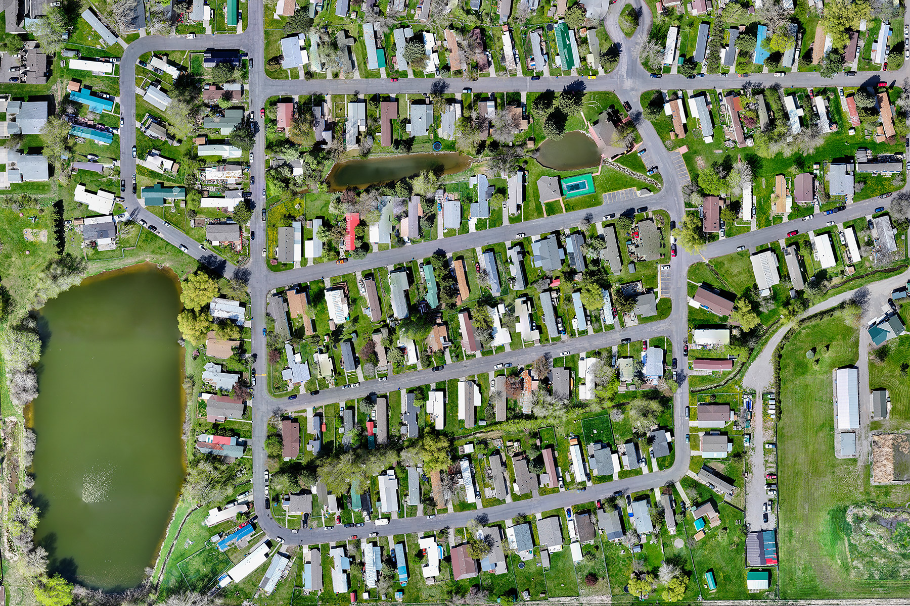
Orthomosaic This drone orthomosaic sample shows approximately 15 overlapping images of a Montana trailer park stitched together in a program called RealityScan. This image has been downsized to 1,800 x 1,200 pixels for web posting. The original is much more detailed, 12,334 x 9,164 pixels. Taking multiple images from a lower altitude allows higher resolution with lower distortion than taking one image from a higher altitude. With drone altitude (above ground level) legally limited to 400 feet or less, it may not be possible to get an entire site into one image, and there will be distortion at the edges. An image like this could be useful for real estate marketing, insurance inspections, construction monitoring and initial project planning purposes, but it does not meet the standards for engineering, surveying or mining. For that you would need high precision images captured by more-specialized drones operated by highly-trained pilots, and it would cost 10-20 times as much as I would charge you for this. (Some of the buzzword acronyms to look for if you need something like that are GNSS, GCP and RTK.) Ballpark, I would charge about $200 plus mileage for something like this, which includes both time on site and processing. |
Home | Videos | Stills | Rates

©2025 Eagle Photo LLC